An African move to change it... What is the Mercator projection that changed the face of the planet?
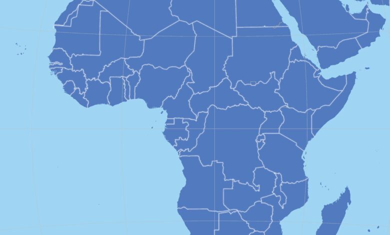
A new map of Africa
Togo leads, by mandate of the Union AfricanThis is an unprecedented international diplomatic movement to change the way the world views the African continent, by demanding the abandonment of the classic "Mercury Projection" and the adoption of a map that highlights the true size of the African continent.
Africa is 14 times larger than Greenland.
The world has long relied on the 16th-century Mercator projection, a mapping system designed by Gerardus Mercator for maritime navigation purposes.
However, this projection faces sharp criticism because it distorts geographical facts; it exaggerates areas near the poles, such as North America and Greenland, while shrinking the size of tropical continents.
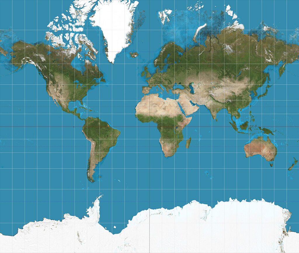
According to reports, the shocking paradox is that the current map shows Greenland as equal to Africa in area, while in reality, Africa covers an area of 30.37 million square kilometers, making it about 14 times larger than Greenland.
Experts believe that this distortion is not just a technical error, but a tool that perpetuates the “marginalization of Africa” in the collective consciousness and international policies.
What is the Mercator projection?
The Mercator projection is a mapping system that transforms the Earth's sphericity into a flat surface. It was invented by Gerardus Mercator in 1569 to facilitate maritime navigation. Its greatest advantage lies in preserving angles and directions, as compass lines appear as straight lines, making it the fundamental standard for navigational charts, GPS systems, and modern web maps like Google Maps.
Conversely, this projection suffers from a significant distortion of areas and distances as we move away from the equator towards the poles, making northern countries appear much larger than they actually are. For example, Greenland appears on the map to be the same size as Africa, while in reality it is 14 times smaller, leading to criticism that it falsifies geographical reality to favor the northern continents.
Togo Initiative
In an interview with Reuters, Togo's Foreign Minister, Robert Dussey, confirmed that his country will formally request the United Nations General Assembly to adopt a map that highlights the "true size" of the continent.
Dossi stressed that the time has come to adopt “scientific truth,” noting that the size currently shown on globes in schools and international organizations is “geographically inaccurate.”.
These moves come in implementation of the African Union’s decision urging its 55 member states to get rid of “Mercurator” and adopt the “Equal Earth” system for 2018, a projection that aims to display countries in their true and proportionate sizes without falsification.
Correct the map campaign
The campaign led by organizations like Africa No Filter and Speak Up for Africa is not just about technical aspects. According to Muki Makura, executive director of Africa No Filter, accurate representation is about “the ability to act and move forward” and ensuring the world sees the continent in its true size and with its real impact, beyond narratives that relegate it to a secondary position.
A political test in the corridors of the United Nations
Minister Dussey revealed that a draft resolution has been prepared that will be put to a vote at the next session of the United Nations General Assembly in September, and described this vote as a “revealing moment” that will show the true positions of countries towards the African continent.
This move comes after a recent African success in securing a UN resolution describing slavery as “the most heinous crime against humanity,” a resolution that witnessed a clear international division, with the European Union and Britain abstaining from voting, while the United States and Israel opposed it, reinforcing expectations that the battle to “rectify the map” will not only be technical, but also a political battle to prove presence and parity on the international stage.